At the beginning of Venetian domination the island was administered by a governor having the title of Bailo. He had both administrative and judicial authority and was elected by the Great Council of Venice for two years. From 1420 the Bailo was assisted by two Counsellors and later by a third official the Provveditore e Capitano who was appointed as Commander of the garrison and also had certain judicial powers. In the early 16th century a Governor General of the Levant was appointed by the Great Council of Venice for a three year term. The administration of the island under the Venetians was fairly liberal for its time.
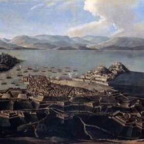
A General Assembly of the Greek and Venetian nobility elected annually one hundred and fifty from among their members to constitute the Council of the Community which appointed the three annual judges. The names of the nobility were registered in the 'Golden Book' (Libro d'Oro). The feudal system was maintained but the number of fiefs was reduced from 24 to 12. The Venetians showed a special interest in agriculture especially in the cultivation of olive-trees. To this policy Corfu owes its countless olive trees which still constitute its main agricultural product. All the commerce was concentrated in Venice so the island's trade was strangled. After the disastrous siege of 1537 the Venetian authorities decided to fortify the city. Works on the fortress lasted almost a century and ended in 1645, making Corfu one of the most heavily fortified places in Europe. Four gates gave access through the walls. One was the Sea Gate opening to the harbour, which still exists intact. Another gate giving access to the countryside was called Porta Reale (Royal Gate) and stood just off the end of the present Evgeniou Voulgareos street. It was pulled down in 1893 to give access to the new suburbs being built outside the old town. Another still extant gate opened on the small bay opposite the north-western corner of the Old Fortress and was called St. Nicholas Gate, after the church which stood and still stands outside the gate. A fourth gate called Porta Raimonda, which was pulled down by the British in 1837, led from the southern bastions through a gallery to the outer fortifications on the Bay of Garitsa. The victory at the second siege of Corfu was the final check (after Lepanto and Vienna) to Ottoman attempts at breaking through to Western Europe, and may be considered an important landmark in the history of Europe. General James Campbell landed in Corfu in May of 1814 after the fall of Napoleon. The islands were constituted by the Treaty of Paris in 1815 as the independent 'United States of the Ionian Islands' under British protection. |
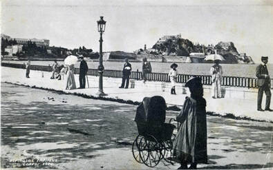
Garitsa Bay, 1900
For the following 50 years the Protective Power was represented in Corfu by 10 successive Lord High Commissioners. The first Constitution of the Ionian Protectorate was drawn up to 1817 leaving all effective power to the hands of the Lord High Commissioner. During this period the building of the palace of St. Michael and St. George was started as seat of the government. In 1823 the first modern Greek University was founded under the name of the Ionian Academy. The University comprised of 4 faculties: Theology, Philosophy, Law and Medicine. A large number of young men came from the other Ionian islands and from mainland Greece to study in Corfu. Also Lord Guilford established the first botanical garden in Greece at Garitsa. On the 27th of September 1859 the Ionian Parliament demanded Union with Greece. On the 21st of May 1864 the Ionian islands united with Greece. |
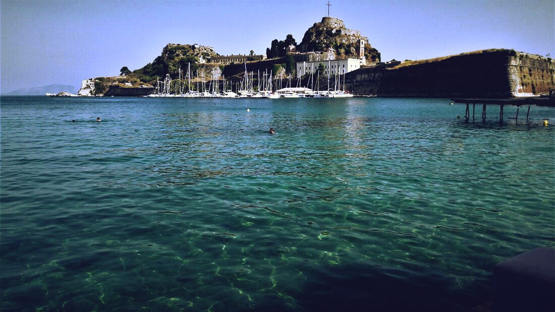
Old Fortress
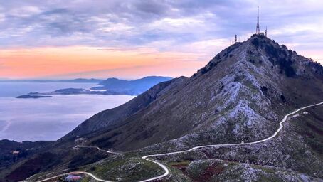
Mt. Pantokrator
|
Kerkyra was inhabited since the Paleolithic Era when it was a part of the mainland and piece of Pindos mountain range.
This elongated island is wide on the North and gets narrower on the South. Its beaches have a total length of 217 km and form several coves and capes. The land is mainly mounty , especially on the North where you will also find picturesque beaches with great views from above such as Paleokastritsa , Logas , Barbati . Two high and well-defined ranges divide the island into three districts, of which the northern is mountainous, the central undulating, and the southern low-lying. The more important of the two ranges, that of Pantokrator (Παντοκράτωρ – the Almighty) stretches east and west from Cape Falacro to Cape Psaromita, and attains its greatest elevation in the summit of the same name. The second range culminates in the mountain of Santa Decca, as it is called by misinterpretation of the Greek designation Άγιοι Δέκα (Hagii Deka) Ten Saints. The whole island, composed as it is of various limestone formations, presents great diversity of surface. Beaches are found in Agios Gordis, the Korission Lagoon, Agios Georgios, Marathia, Kassiopi, Sidari, Palaiokastritsa and many others. Corfu is located near the Kefalonia geological fault formation earthquakes have occurred. Corfu's coastline spans 217 kilometres including capes its highest point is Mount Pantokrator (2,989 ft) and the second Stravoskiadi, at 849 m (2,785 ft). The full extent of capes and promontories take in Agia Aikaterini, Drastis to the north, Lefkimmi and Asprokavos to the southeast, and Megachoro to the south. Two islands are also to be found at a middle point of Gouvia and Corfu Bay, which extends across much of the eastern shore of the island; are known as Lazareto and Ptychia (or Vido). |